Extreme weather
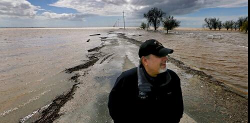
To get a sense of the enormous amount of water atmospheric rivers dumped on the Western U.S. this year and the magnitude of the flood risk ahead, take a look at California’s Central Valley, where about a quarter of the nation’s food is grown. This region was once home to the largest freshwater lake west of the Rockies. But the rivers that fed Tulare Lake were dammed and diverted long ago, leaving it nearly dry by 1920. Farmers have been growing food on the fertile lake bed for decades. This year, however, Tulare Lake is remerging. Runoff and snowmelt from the Sierra Nevada have overwhelmed waterways and flooded farms and orchards. After similar storms in 1983, the lake covered more than 100 square miles, and scientists say this year’s precipitation is looking a lot like 1983. Communities there and across the West are preparing for flooding and mudslide disasters as record snow begins to melt. Tulare Lake, long dry, begi...
When a powerful storm flooded neighborhoods in Fort Lauderdale, Florida, in April with what preliminary reports show was 25 inches of rain in 24 hours, few people were prepared. Even hurricanes rarely drop that much rain in one area that fast. Residents could do little to stop the floodwater as it spread over their yards and into their homes. Studies show that as global temperatures rise, more people will be at risk from such destructive flooding – including in areas far from the coasts that rarely faced extreme flooding in the past. In many of these communities, the people at greatest risk of harm from flash flooding are low-wage workers, older adults and other vulnerable residents who live in low-lying areas and who have few resources to protect their properties and themselves. I study the impact of extreme weather on vulnerable communities as an assistant professor of social work. To limit the damage, communities need to know who is at risk and how they can be better...
Meteorologists began warning about severe weather with the potential for tornadoes several days before storms tore across the Southeast and the Central U.S. in late March 2023. At one point, more than 28 million people were under a tornado watch. But pinpointing exactly where a tornado will touch down – like the tornadoes that hit Rolling Fork, Mississippi, on March 24, and towns in Arkansas, Illinois and multiple other states on March 31 – still relies heavily on seeing the storms developing on radar. Chris Nowotarski, an atmospheric scientist, explains why, and how forecast technology is improving. Why are tornadoes still so difficult to forecast? Meteorologists have gotten a lot better at forecasting the conditions that make tornadoes more likely. But predicting exactly which thunderstorms will produce a tornado and when is harder, and that’s where a lot of severe weather research is focused today. Often, you’ll have a line of thunderstorms in an envi...
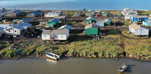
As winds and waves from Typhoon Merbok devastated communities along the coast of Western Alaska in 2022, Reppi Swan Sr.’s phone began to ring at Kivalina, a barrier island 80 miles above the Arctic Circle. A neighboring family had lost 3 feet of land to the rumbling lagoon, and their home was now sitting just 6 feet from the angry water’s edge. Reppi called his brother Joe Swan Jr. and quickly slid into his insulated rain gear. As a volunteer first responder, Reppi plans for emergencies like this. He and his wife, Dolly, had been patrolling the island for dangerous erosion every few hours during the storm. To prepare, he had already inspected the city’s heavy equipment and located a pile of boulders left over from a recent construction project. Working through the rain, Reppi delivered boulders to the threatened home. With their cousin Carl Swan serving as a spotter, Joe carefully arranged the boulders with a backhoe to stabilize the bank. It would hold at lea...
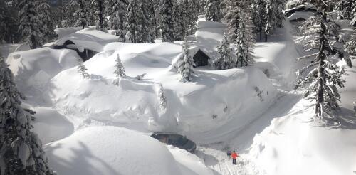
Another round of powerful atmospheric rivers is hitting California, following storms in January and February 2023 that dumped record amounts of snow. This time, the storms are warmer, and they are triggering flood warnings as they bring rain higher into the mountains – on top of the snowpack. Professor Keith Musselman, who studies water and climate change at the University of Colorado’s Institute of Arctic and Alpine Research, explained the complex risks rain on snow creates and how they might change in a warming climate. What happens when rain falls on snowpack? For much of the United States, storms with heavy rainfall can coincide with seasonal snow cover. When that happens, the resulting runoff of water can be much greater than what is produced from rain or snowmelt alone. The combination has resulted in some of the nation’s most destructive and costly floods, including the 1996 Midwest floods and the 2017 flood that damaged California’s Oroville Dam....


