https://www.lifegate.it/timelapse-in-google-earth
- |
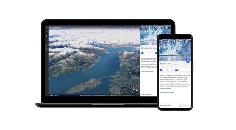
Is it possible to travel through time?Certainly not, you might say.From today 15 April, however, things change:thanks to Timelapse in Google Earth, the most significant update of the platform since 2017, we will be able to take a dive into the past and see what our Planet was like when, perhaps, we were not yet born.We will be able to understand how it has changed over the years, especially with climate change and human activities.

How Timelapse works in Google Earth
How does it work?Simply go to the dedicated site and use the convenient search bar to select any location and observe the passage of time.You can also choose to witness the evolution of five specific phenomena:forest change, urban development, increase in temperatures, energy sources and the fragile beauty of the Earth.Alternatively, go up Google Earth and click on the rudder icon.
The role of satellite images
Timelapse is an interactive 3D experience born thanks to the close collaboration between Google Earth, the European Space Agency (Hex), European Commission, NASA And US geological survey.They have been collected 24 million satellite images from the last 37 years, thus making one of the most complete visual representations of the evolving Earth available to the public.

We can finally see climate change with our own eyes
“Our planet has seen rapid environmental change over the last half century,” he says Rebecca Moore, Google Earth director, Earth engine & outreach.“Many of us have experienced these changes in our cities;I myself witnessed the fires in California.For other people, the effects of climate changes they seem abstract and distant, like the melting of ice.With Timelapse in Google Earth we have a clearer picture of the changing world right at our fingertips – showing not just the problems, but the solutions.”
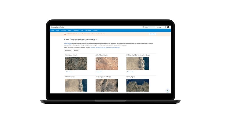
Furthermore, they have been uploaded online more than 800 time-lapse videos in 2D and 3D, so you can watch them comfortably in MP4 format rather than on YouTube.“Whether it's governments, researchers, publishers, teachers or advocates, we can't wait to see how Timelapse in Google Earth will be used by people to shed light on the most important issues we face today,” Moore continues.

What is the goal of Timelapse in Google Earth
Both NASA and the European Commission have underlined the importance of ensuring access to this data:to raise public awareness, collect more and more useful information to understand how to protect the biodiversity, and push governments to adopt policies of adaptation and mitigation to tackle the climate crisis.
“The use of Sentinel satellite data Copernicus program allows millions of people to explore evolutions on Earth.We are analyzing all aspects of changes on our planet, whether natural or man-made events, and the impact they have on the climate,” he continues Maurice Borgeaud, head of the Science, Applications and Climate Department of ESA's Earth Observation Programmes.
The involvement of young people
Once again, when our future is at stake, it is the new generations that make themselves felt with particular force.In this case, we are talking about Liza Goldberg, a Stanford University student and NASA intern who used satellite images to monitor the loss of mangrove forests.Goldberg also created Cloud to classroom, a program to educate students on issues related to environmental protection through the use of images provided by satellites.
“It's not about zooming in, it's about zooming out”, concludes Rebecca Moore.We could translate it like this:“It's not about getting closer, but about moving away.”To have a broader view of the Planet and the problems that afflict it.And, perhaps, also to leave nature the space it deserves.
