La Nina
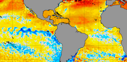
The North Atlantic Ocean has been running a fever for months, with surface temperatures at or near record highs. But cooling along the equator in both the Atlantic and eastern Pacific may finally be starting to bring some relief, particularly for vulnerable coral reef ecosystems. This cooling comes from two climate phenomena with similar names: La Niña, which forms in the tropical Pacific, and the less well-known Atlantic Niña. Both can affect the Atlantic hurricane season. While La Niña tends to bring conditions ideal for Atlantic hurricanes, the less powerful Atlantic Niña has the potential to reduce some of the hurricane risk. Cooling in the tropical Atlantic along the equator is a sign an Atlantic Niña may be forming. NOAA Climate.gov We’re ocean and atmospheric scientists who study this type of climate phenomenon. It’s rare to see both Niñas at the same...
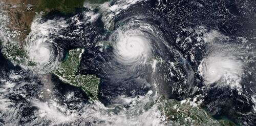
The 2024 Atlantic hurricane season starts on June 1, and forecasters are predicting an exceptionally active season. If the National Hurricane Center’s early forecast, released May 23, is right, the North Atlantic could see 17 to 25 named storms, eight to 13 hurricanes, and four to seven major hurricanes by the end of November. That’s the highest number of named storms in any NOAA preseason forecast. Other forecasts for the season have been just as intense. Colorado State University’s early outlook, released in April, predicted an average of 23 named storms, 11 hurricanes and five major hurricanes. The European Centre for Medium-Range Weather Forecasts anticipates 21 named storms. Colorado State also forecasts a whopping 210 accumulated cyclone energy units for 2024, and NOAA forecasts the second-highest ACE on record. Accumulated cyclone energy is a score for how active a given season is by combining intensity and duration of all storms occurring within a gi...
One of the big contributors to the record-breaking global temperatures over the past year – El Niño – is now gone, and its opposite, La Niña, is on the way. Whether that’s a relief or not depends in part on where you live. Above-normal temperatures are still forecast across the U.S. in summer 2024. And if you live along the U.S. Atlantic or Gulf coasts, La Niña can contribute to the worst possible combination of climate conditions for fueling hurricanes. Pedro DiNezio, an atmosphere and ocean scientist at the University of Colorado who studies El Niño and La Niña, explains why and what’s ahead. What is La Niña? La Niña and El Niño are the two extremes of a recurring climate pattern that can affect weather around the world. Forecasters know La Niña has arrived when temperatures in the eastern Pacific Ocean along the equator west of South America cool by at least half a degree Celsius (0.9 Fahrenheit) below no...
To understand how important weather and climate risks are to the economy, watch investors. New research shows that two long-range seasonal weather forecasts in particular can move the stock market in interesting ways. We often think about forecasts as telling us what the weather will bring in coming days, but the National Oceanic and Atmospheric Administration also predicts weather conditions several months out. These seasonal climate outlooks tell us whether the hurricane season is likely to be active, whether the winter is likely to be snowy or cold, and whether an El Niño or La Niña climate pattern is likely to emerge with the potential to influence weather across the U.S. I study the impacts of weather on economic activity as an economist. In a new paper, an atmospheric scientist at NOAA and I analyzed the influence of long-range forecasts by looking at the changing prices of stock options over 10 years and thousands of companies. We found that investors are payin...
Wild weather has been roiling North America for the past few months, thanks in part to a strong El Niño that sent temperatures surging in 2023. The climate phenomenon fed atmospheric rivers drenching the West Coast and contributed to summer’s extreme heat in the South and Midwest and fall’s wet storms across the East. That strong El Niño is now starting to weaken and will likely be gone by late spring 2024. So, what does that mean for the months ahead – and for the 2024 hurricane season? What is El Niño? Let’s start with a quick look at what an El Niño is. El Niño and its opposite, La Niña, are climate patterns that influence weather around the world. El Niño tends to raise global temperatures, as we saw in 2023, while La Niña events tend to be slightly cooler. The two result in global temperatures fluctuating above and below the warming trend set by climate change. El Niño starts as warm water builds up a...


