Storm surge
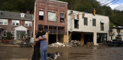
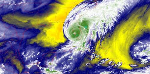
Some hurricanes are remembered for their wind damage or rainfall. Others for their coastal flooding. Hurricane Helene was a stew of all of that and more. Its near-record-breaking size, storm surge, winds and rainfall together turned Helene into an almost unimaginable disaster that stretched more than 500 miles inland from the Florida coast. At least 230 people died across Florida, Georgia, South Carolina, North Carolina, Tennessee and Virginia as Helene flooded towns, destroyed roads and bridges and swept away homes. In Florida, Helene’s storm surge caused damage along hundreds of miles of coast. As residents there cleaned up debris, another dangerous hurricane was headed their way. Some of the same areas hit hard by Helene on Sept. 26, 2024 – including Tampa Bay and Cedar Key – were forecast to see more flooding and an even higher storm surge in Tampa Bay from Hurricane Milton, expected to make landfall as early as Oct. 9. The majority of Helene’s vic...
Hurricane Ian hit Florida in September 2022 as one of the United States’ most powerful hurricanes on record, and it followed a two-week string of massive, devastating storms around the world. A few days earlier in the Philippines, Typhoon Noru gave new meaning to rapid intensification when it blew up from a tropical storm with 50 mph winds to a Category 5 monster with 155 mph winds the next day. Hurricane Fiona flooded Puerto Rico, then became Canada’s most intense storm on record. Typhoon Merbok gained strength over a warm Pacific Ocean and tore up over 1,000 miles of the Alaska coast. Major storms hit from the Philippines in the western Pacific to the Canary Islands in the eastern Atlantic, to Japan and Florida in the middle latitudes and western Alaska and the Canadian Maritimes in the high latitudes. A lot of people are asking about the role rising global temperatures play in storms like these. It’s not always a simple answer....
Hurricane Ian strengthened into a major hurricane on Tuesday as it headed for Florida and was on track to bring dangerous storm surge to the coast and flooding rainfall to large parts of the state. Several areas were under evacuation orders. After a slow start to the 2022 Atlantic hurricane season, Ian formed in ideal conditions, with minimal vertical wind shear, which can tear apart a storm, and warm ocean surface waters providing fuel. Forecasters expect Ian to remain a major hurricane – meaning Category 3 or higher on the Saffir-Simpson Hurricane Wind Scale, with winds over 110 mph – as it heads for landfall in Florida, expected Wednesday. But the scale doesn’t take water risk into account, and flooding and storm surge are both major risks from Ian. Large parts of the state could see 15 inches or more of rain from Hurricane Ian. National Hurricane Center As a meteorologist livin...
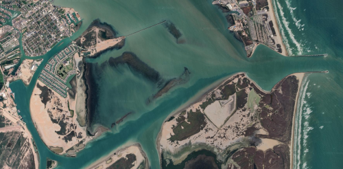
Centuries ago, estuaries around the world were teeming with birds and turbulent with schools of fish, their marshlands and endless tracts of channels melting into the gray-blue horizon. Fast-forward to today, and in estuaries such as New York Harbor, San Francisco Bay and Miami’s Biscayne Bay – areas where rivers meet the sea – 80% to 90% of this habitat has been built over. The result has been the environmental collapse of estuary habitats and the loss of buffer zones that helped protect cities from storm surge and sea-level rise. But the damage isn’t just what’s visible on land. Below the surface of many of the remaining waterways, another form of urbanization has been slowly increasing the vulnerability of coastlines to extreme storms and sea-level rise: Vast dredging and engineering projects have more than doubled the depths of shipping channels since the 19th century. Side-by-side illustrations sho...


