Climate change
When people think about the risks of climate change, the idea of abrupt changes is pretty scary. Movies like “The Day After Tomorrow” feed that fear, with visions of unimaginable storms and populations fleeing to escape rapidly changing temperatures. While Hollywood clearly takes liberties with the speed and magnitude of disasters, several recent studies have raised real-world alarms that a crucial ocean current that circulates heat to northern countries might shut down this century, with potentially disastrous consequences. That scenario has happened in the past, most recently more than 16,000 years ago. However, it relies on Greenland shedding a lot of ice into the ocean. Our new research, published in the journal Science, suggests that while Greenland is indeed losing huge and worrisome volumes of ice right now, that might not continue for long enough to shut down the current on its own. A closer look at evidence from the past shows why. Blood and water The Atl...
In the popular imagination, the Caribbean is paradise, an exotic place to escape to. But behind the images of balmy beaches and lush hotel grounds lies a crisis, the likes of which its residents have never experienced. Caribbean islands are in a water crisis, and their governments have warned that water scarcity may become the new norm. Within the past five years, every island in the region has experienced some sort of water scarcity. For example, Trinidad is experiencing its worst drought in recent memory, and residents are under water restrictions through at least the end of June 2024, with fines for anyone who violates the rules. Dominica, considered the nature island of the Caribbean for its mountain rain forests, is seeing a significant decrease in freshwater resources and increasingly frequent water shortages. In Grenada, known as the spice isle, drought has affected water systems throughout the island. Apartments in Havana, Cuba,...
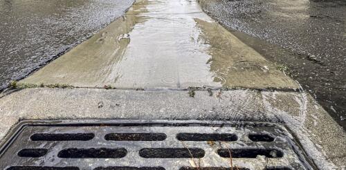
“When it rains, it pours” once was a metaphor for bad things happening in clusters. Now it’s becoming a statement of fact about rainfall in a changing climate. Across the continental U.S., intense single-day precipitation events are growing more frequent, fueled by warming air that can hold increasing levels of moisture. Most recently, areas north of Houston received 12 to 20 inches (30 to 50 centimeters) of rain in several days in early May 2024, leading to swamped roads and evacuations. Earlier in the year, San Diego received 2.72 inches (7 centimeters) of rain on Jan. 22 that damaged nearly 600 homes and displaced about 1,200 people. Two weeks later, an atmospheric river dumped 5 to 10 inches (12 to 25 centimeters) of rain on Los Angeles, causing widespread mudslides and leaving more than a million people without power. Events like these have sparked interest in so-called sponge cities – a comprehensive approach to urban flood mitigation that uses i...
Dozens of wildfires are burning across Canada in May 2024 and sending unhealthy smoke blowing into the northern U.S. again. At the same time, the southeastern U.S. is getting smoke from Mexico, where drought conditions have been fueling fires. Last year, Canada’s record 2023 wildfire season introduced millions of Americans across the Midwest and northeastern states to the health hazards of wildfire smoke, with air quality alerts that reached levels never seen there before. Professional baseball games were postponed and the skies in New York City turned orange with haze, at times exposing millions of people to the worst air quality in the world. In some regions, the smoke hung on for days. The pressing question on many people’s minds: “Is this the new normal?” From our perspective as air quality scientists, we think the answer is likely “yes.” Global warming means more fires Hotter, drier conditions, coupled with dry grasses and underbrush...
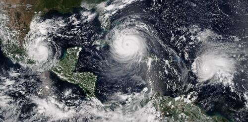
The 2024 Atlantic hurricane season starts on June 1, and forecasters are predicting an exceptionally active season. If the National Hurricane Center’s early forecast, released May 23, is right, the North Atlantic could see 17 to 25 named storms, eight to 13 hurricanes, and four to seven major hurricanes by the end of November. That’s the highest number of named storms in any NOAA preseason forecast. Other forecasts for the season have been just as intense. Colorado State University’s early outlook, released in April, predicted an average of 23 named storms, 11 hurricanes and five major hurricanes. The European Centre for Medium-Range Weather Forecasts anticipates 21 named storms. Colorado State also forecasts a whopping 210 accumulated cyclone energy units for 2024, and NOAA forecasts the second-highest ACE on record. Accumulated cyclone energy is a score for how active a given season is by combining intensity and duration of all storms occurring within a gi...


