Extreme weather
Dozens of wildfires are burning across Canada in May 2024 and sending unhealthy smoke blowing into the northern U.S. again. At the same time, the southeastern U.S. is getting smoke from Mexico, where drought conditions have been fueling fires. Last year, Canada’s record 2023 wildfire season introduced millions of Americans across the Midwest and northeastern states to the health hazards of wildfire smoke, with air quality alerts that reached levels never seen there before. Professional baseball games were postponed and the skies in New York City turned orange with haze, at times exposing millions of people to the worst air quality in the world. In some regions, the smoke hung on for days. The pressing question on many people’s minds: “Is this the new normal?” From our perspective as air quality scientists, we think the answer is likely “yes.” Global warming means more fires Hotter, drier conditions, coupled with dry grasses and underbrush...
A deadly heat wave gripped Asia for weeks in spring 2024, sending temperatures in India’s capital region over 120 degrees Fahrenheit (49 Celsius) in May. Campaigning politicians, news announcers and Indian voters waiting in long lines passed out in the oppressive heat. In June, hundreds of people on the Hajj, a Muslim pilgrimage to Mecca, Saudi Arabia, died in searing heat that reached 120 F (49 C) with high humidity. Most of the planet has suffered the dire effects of extreme heat in recent years. Phoenix hit 110 F (43.3 C) or higher for 31 straight days in summer 2023, and Europe saw unprecedented heat that killed hundreds and contributed to devastating wildfires in Greece. Mexico and neighboring regions were sweltering through a dangerous and long-running heat wave in 2024. Regardless of where or when a heat wave strikes, one pattern has been a constant: Older adults are the most likely to die from extreme heat, and the crisis is worsening....
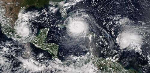
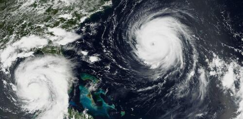
The 2024 Atlantic hurricane season starts on June 1, and forecasters are predicting an exceptionally active season. If the National Hurricane Center’s early forecast, released May 23, is right, the North Atlantic could see 17 to 25 named storms, eight to 13 hurricanes, and four to seven major hurricanes by the end of November. That’s the highest number of named storms in any NOAA preseason forecast. Other forecasts for the season have been just as intense. Colorado State University’s early outlook, released in April, predicted an average of 23 named storms, 11 hurricanes and five major hurricanes. The European Centre for Medium-Range Weather Forecasts anticipates 21 named storms. Colorado State also forecasts a whopping 210 accumulated cyclone energy units for 2024, and NOAA forecasts the second-highest ACE on record. Accumulated cyclone energy is a score for how active a given season is by combining intensity and duration of all storms occurring within a gi...
Weather forecasters talk about wind shear a lot during hurricane season, but what exactly is it? I teach meteorology at Georgia Tech, in a part of the country that pays close attention to the Atlantic hurricane season. Here’s a quick look at one of the key forces that can determine whether a storm will become a destructive hurricane. What is wind shear? Wind shear is defined as the change in wind speed, wind direction, or both, over some distance. You may have heard airplane pilots talk about turbulence and warn passengers that they’re in for a bumpy ride. They’re typically seeing signs of sudden changes in wind speed or wind direction directly ahead, and wind shear can sometimes cause this. With hurricanes, the focus is usually on vertical wind shear, or how wind changes in speed and direction with height. The effects of wind shear when wind speed increases with height (left) or changes direction (right)....
One of the big contributors to the record-breaking global temperatures over the past year – El Niño – is now gone, and its opposite, La Niña, is on the way. Whether that’s a relief or not depends in part on where you live. Above-normal temperatures are still forecast across the U.S. in summer 2024. And if you live along the U.S. Atlantic or Gulf coasts, La Niña can contribute to the worst possible combination of climate conditions for fueling hurricanes. Pedro DiNezio, an atmosphere and ocean scientist at the University of Colorado who studies El Niño and La Niña, explains why and what’s ahead. What is La Niña? La Niña and El Niño are the two extremes of a recurring climate pattern that can affect weather around the world. Forecasters know La Niña has arrived when temperatures in the eastern Pacific Ocean along the equator west of South America cool by at least half a degree Celsius (0.9 Fahrenheit) below no...


