Weather
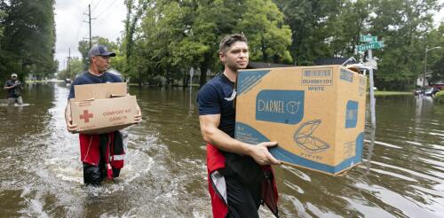
Tropical Storm Debby was moving so slowly, Olympians could have outrun it as it moved across the Southeast in early August 2024. That gave its rainfall time to deluge cities and farms over large parts of Florida, Georgia and the Carolinas. More than a foot of rain had fallen in some areas by early Aug. 7, 2024, with more days of rain forecast there and into the Northeast. Mathew Barlow, a climate scientist at UMass Lowell, explains how storms like Debby pick up so much moisture, what can cause them to slow or stall, and what climate change has to do with it. What causes hurricanes to stall? Hurricanes are steered by the weather systems they interact with, including other storms moving across the U.S. and the Bermuda High over the Atlantic Ocean. A hurricane may be moving slowly because there are no weather systems close enough to pull the hurricane along, or there might be a high-pressure system to the north of the hurricane that blocks its forward movement. In this case,...
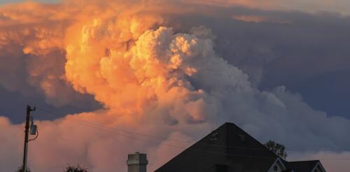
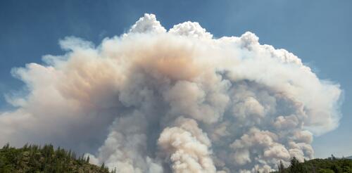
Wildfire blowups, fire whirls, towering thunderstorms: When fires get large and hot enough, they can actually create their own weather. In these extreme fire situations, firefighters’ ordinary methods to directly control the fire don’t work, and wildfires burn out of control. Firefighters have seen many of these risks in the enormous Park Fire burning near Chico, California, and other wildfires in summer 2024. But how can a fire create weather? Satellite images show how the Park Fire near Chico, Calif., created intense pyrocumulonimbus plumes, visible in white, in July 2024. CSU/CIRA and NOAA I’m an atmospheric scientist who uses data collected by satellites in weather prediction models to better anticipate extreme fire weather phenomena. Satellite data shows fire-produced thunderstorms are much more common than anyone realized just a few years ago. Here’s what’s happ...
Tropical Storm Debby was moving so slowly, Olympians could have outrun it as it moved across the Southeast in early August 2024. That gave its rainfall time to deluge cities and farms over large parts of Florida, Georgia and the Carolinas. More than a foot of rain had fallen in some areas by early Aug. 7, 2024, with more days of rain forecast there and into the Northeast. Mathew Barlow, a climate scientist at UMass Lowell, explains how storms like Debby pick up so much moisture, what can cause them to slow or stall, and what climate change has to do with it. What causes hurricanes to stall? Hurricanes are steered by the weather systems they interact with, including other storms moving across the U.S. and the Bermuda High over the Atlantic Ocean. A hurricane may be moving slowly because there are no weather systems close enough to pull the hurricane along, or there might be a high-pressure system to the north of the hurricane that blocks its forward movement. In this case,...
Wildfire blowups, fire whirls, towering thunderstorms: When fires get large and hot enough, they can actually create their own weather. In these extreme fire situations, firefighters’ ordinary methods to directly control the fire don’t work, and wildfires burn out of control. But how can a fire create weather? Satellite images show how the Park Fire near Chico, Calif., created intense pyrocumulonimbus plumes, visible in white, in July 2024. CSU/CIRA and NOAA I’m an atmospheric scientist who uses data collected by satellites in weather prediction models to better anticipate extreme fire weather phenomena. Satellite data shows fire-produced thunderstorms are much more common than anyone realized just a few years ago. Here’s what’s happening. The wildfire and weather connections Imagine a wildland landscape with dry grasses, brush and trees. A spark lands, perhaps from...
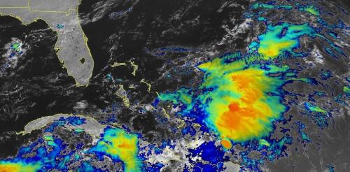
When tropical meteorologists peer at satellite images, they often catch sight of subtle cloud formations hinting at something more ominous brewing. The first signs of a potential hurricane can be detected days before a storm gains its fierce momentum. Wispy cirrus clouds radiating outward, the appearance of curved banding low-level clouds and a drop in atmospheric pressure are all clues. These early clues are crucial for predicting the onset of what might develop into a catastrophic hurricane. I am a meteorology professor at Penn State, and my research group uses satellites and computer models to improve forecasting of tropical weather systems. With an especially fierce Atlantic storm season forecast for 2024, being able to detect these initial signals and provide early warnings is more important than ever. Here’s what forecasters look for. Hurricane Harvey entered the Gulf of Mexico as a tropical wave before reorganizing into a tropical storm a...


