Atmospheric science
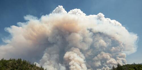
Wildfire blowups, fire whirls, towering thunderstorms: When fires get large and hot enough, they can actually create their own weather. In these extreme fire situations, firefighters’ ordinary methods to directly control the fire don’t work, and wildfires burn out of control. But how can a fire create weather? Satellite images show how the Park Fire near Chico, Calif., created intense pyrocumulonimbus plumes, visible in white, in July 2024. CSU/CIRA and NOAA I’m an atmospheric scientist who uses data collected by satellites in weather prediction models to better anticipate extreme fire weather phenomena. Satellite data shows fire-produced thunderstorms are much more common than anyone realized just a few years ago. Here’s what’s happening. The wildfire and weather connections Imagine a wildland landscape with dry grasses, brush and trees. A spark lands, perhaps from...
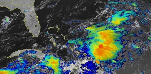
When tropical meteorologists peer at satellite images, they often catch sight of subtle cloud formations hinting at something more ominous brewing. The first signs of a potential hurricane can be detected days before a storm gains its fierce momentum. Wispy cirrus clouds radiating outward, the appearance of curved banding low-level clouds and a drop in atmospheric pressure are all clues. These early clues are crucial for predicting the onset of what might develop into a catastrophic hurricane. I am a meteorology professor at Penn State, and my research group uses satellites and computer models to improve forecasting of tropical weather systems. With an especially fierce Atlantic storm season forecast for 2024, being able to detect these initial signals and provide early warnings is more important than ever. Here’s what forecasters look for. Hurricane Harvey entered the Gulf of Mexico as a tropical wave before reorganizing into a tropical storm a...
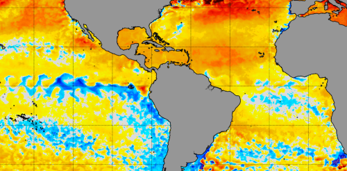
The North Atlantic Ocean has been running a fever for months, with surface temperatures at or near record highs. But cooling along the equator in both the Atlantic and eastern Pacific may finally be starting to bring some relief, particularly for vulnerable coral reef ecosystems. This cooling comes from two climate phenomena with similar names: La Niña, which forms in the tropical Pacific, and the less well-known Atlantic Niña. Both can affect the Atlantic hurricane season. While La Niña tends to bring conditions ideal for Atlantic hurricanes, the less powerful Atlantic Niña has the potential to reduce some of the hurricane risk. Cooling in the tropical Atlantic along the equator is a sign an Atlantic Niña may be forming. NOAA Climate.gov We’re ocean and atmospheric scientists who study this type of climate phenomenon. It’s rare to see both Niñas at the same...
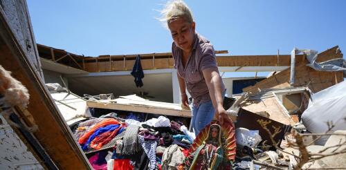
Spring 2024 was unnerving for people across large parts of the U.S. as tornado warnings and sirens sent them scrambling for safety. More than 1,100 tornadoes were reported through May − a preliminary number but nearly twice the 30-year average at that point and behind only 2011, when deadly tornado outbreaks tore across the southeastern U.S. The U.S. experienced several multistate outbreaks in 2024. Tornadoes damaged homes from Texas to Minnesota and east to West Virginia and Georgia. They caused widespread destruction in several towns, including Greenfield, Iowa; Westmoreland, Kansas; and Bartlesville, Oklahoma. Barnsdall, Oklahoma, was hit twice in two months. In May, at least one tornado occurred somewhere in the country almost every day. Greenfield, Iowa, after a powerful EF4 tornado cut through the city on May 21, 2024, amid a deadly tornado outbreak. What causes some years to have so many tornadoes? I’m a meteorologist w...
Food’s role in climate change has emerged as one of the defining challenges of our time. The journey of a steak, fruit or salad from the vast expanses of agricultural lands to the plates on our tables leaves a significant footprint on the environment. As earth, climate and atmospheric scientists, we track global greenhouse gas emissions and just published the most comprehensive assessment yet of a powerful greenhouse gas from food production: nitrous oxide, or N₂O. After carbon dioxide and methane, N₂O is the most consequential greenhouse gas humans are releasing into the atmosphere. While there is less N₂O than carbon dioxide in the atmosphere, it is 300 times more powerful at warming the planet, and it remains in the atmosphere, holding in heat, for over a century. Today, atmospheric N₂O levels are about 25% higher than before the Industrial Revolution, and they’re still rising at an accelerating rate....


