Flood risk
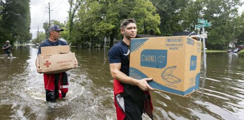
Tropical Storm Debby was moving so slowly, Olympians could have outrun it as it moved across the Southeast in early August 2024. That gave its rainfall time to deluge cities and farms over large parts of Florida, Georgia and the Carolinas. More than a foot of rain had fallen in some areas by early Aug. 7, 2024, with more days of rain forecast there and into the Northeast. Mathew Barlow, a climate scientist at UMass Lowell, explains how storms like Debby pick up so much moisture, what can cause them to slow or stall, and what climate change has to do with it. What causes hurricanes to stall? Hurricanes are steered by the weather systems they interact with, including other storms moving across the U.S. and the Bermuda High over the Atlantic Ocean. A hurricane may be moving slowly because there are no weather systems close enough to pull the hurricane along, or there might be a high-pressure system to the north of the hurricane that blocks its forward movement. In this case,...
Tropical Storm Debby was moving so slowly, Olympians could have outrun it as it moved across the Southeast in early August 2024. That gave its rainfall time to deluge cities and farms over large parts of Florida, Georgia and the Carolinas. More than a foot of rain had fallen in some areas by early Aug. 7, 2024, with more days of rain forecast there and into the Northeast. Mathew Barlow, a climate scientist at UMass Lowell, explains how storms like Debby pick up so much moisture, what can cause them to slow or stall, and what climate change has to do with it. What causes hurricanes to stall? Hurricanes are steered by the weather systems they interact with, including other storms moving across the U.S. and the Bermuda High over the Atlantic Ocean. A hurricane may be moving slowly because there are no weather systems close enough to pull the hurricane along, or there might be a high-pressure system to the north of the hurricane that blocks its forward movement. In this case,...
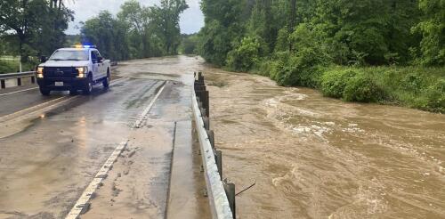
The French Broad River winds through the mountains of western North Carolina, fed by dozens of mountain streams, and crosses the city of Asheville. At over 2,000 feet above sea level and more than 250 miles from the coast, it is an unlikely place to prepare for a hurricane. Yet, the remnants of several hurricanes have swept through this region over the years, sending rivers in the region raging out of their banks. When these storms hit back to back, the devastation can be enormous. In September 2004, for example, remnants of Hurricanes Frances, Ivan and Jeanne all brought excessive rain to western North Carolina in the span of a few weeks, overwhelming the French Broad and other rivers in the Asheville area. Western North Carolina’s history is just one example of the inland risks from tropical cyclones. A U.S. map of hurricane storm tracks since 1851 shows that the storms and their remnants often travel far inland. Yellows to reds...
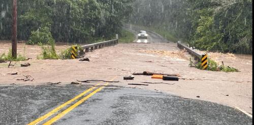
Scenes from the Houston area looked like the aftermath of a hurricane in early May 2024 after a series of powerful storms flooded highways and neighborhoods and sent rivers over their banks north of the city. Hundreds of people had to be rescued from homes, rooftops and cars during storms, according to The Associated Press. Huntsville registered nearly 20 inches of rain from April 29 to May 4. More storm systems over the following weeks blew out windows in Houston high rises and caused more flash flooding on urban streets and already saturated ground in the region. Floods are complex events, and they are about more than just heavy rain. Each community has its own unique geography and climate that can exacerbate flooding. On top of those risks, extreme downpours are becoming more common as global temperatures rise. I work with a center at the University of Michigan that helps communities turn climate knowledge into projects that can reduce the harm of future climate disasters. F...
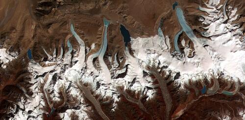
In August 2023, residents of Juneau, Alaska, watched as the Mendenhall River swelled to historic levels in a matter of hours. The rushing water undercut the riverbank and swallowed whole stands of trees and multiple buildings. The source for the flood was not heavy rainfall – it was a small glacial lake located in a side valley next to the Mendenhall Glacier. Glacier-dammed lakes like this are abundant in Alaska. They form when a side valley loses its ice faster than the main valley, leaving an ice-free basin that can fill with water. These lakes may remain stable for years, but often they reach a tipping point, when high water pressure opens a channel underneath the glacier. The rapid and catastrophic drainage of lake water that follows is called a glacial lake outburst flood, or GLOF for short. The flood waters race downstream over hours or days and often hit unexpectedly. Suicide Basin, a glacier-dammed lake, has flooded the Mendenhall River...


