Meteorology
El Niño is officially here, and while it’s still weak right now, federal forecasters expect this global disrupter of worldwide weather patterns to gradually strengthen. That may sound ominous, but El Niño – Spanish for “the little boy” – is not malevolent, or even automatically bad. Here’s what forecasters expect, and what it means for the U.S. What is El Niño? El Niño is a climate pattern that starts with warm water building up in the tropical Pacific west of South America. This happens every three to seven years or so. It might last a few months or a couple of years. Normally, the trade winds push warm water away from the coast there, allowing cooler water to surface. But when the trade winds weaken, water near the equator can heat up, and that can have all kinds of effects through what are known as teleconnections. The ocean is so vast – covering approximately one-third of the planet, or about 15 times the size...
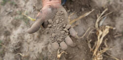
Flash droughts develop fast, and when they hit at the wrong time, they can devastate a region’s agriculture. They’re also becoming increasingly common as the planet warms. In a new study published May 25, 2023, we found that the risk of flash droughts, which can develop in the span of a few weeks, is on pace to rise in every major agriculture region around the world in the coming decades. In North America and Europe, cropland that had a 32% annual chance of a flash drought a few years ago could have as much as a 53% annual chance of a flash drought by the final decades of this century. The result would put food production, energy and water supplies under increasing pressure. The cost of damage will also rise. A flash drought in the Dakotas and Montana in 2017 caused US$2.6 billion in agricultural damage in the U.S. alone. Stunted corn in Nebraska struggles to grow during the 2012 flash drought that covered much of the cent...
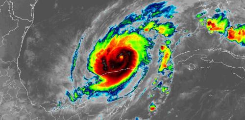
Hurricane Milton became one of the most rapidly intensifying storms on record as it went from barely hurricane strength to a dangerous Category 5 storm in less than a day on a path across the Gulf of Mexico toward Florida. With sustained winds that reached 180 mph on Oct. 7, 2024, and very low pressure, it also became one of the strongest Atlantic storms. Milton’s winds dipped to Category 4 strength early on Oct. 8, but forecasters warned that it would still be an extremely dangerous hurricane at landfall. Less than two weeks after Hurricane Helene’s devastating impact, this kind of storm was the last thing Florida wanted to see. Hurricane Milton was expected to make landfall as a major hurricane on Oct. 9 and had already prompted widespread evacuations. Hurricane Milton’s projected storm track, as of midday Oct. 7, 2024, as it grew into a major hurricane (M). Storm tracks are projections, and Milton’s path co...
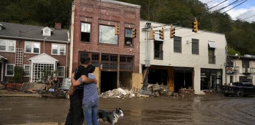
Some hurricanes are remembered for their wind damage or rainfall. Others for their coastal flooding. Hurricane Helene was a stew of all of that and more. Its near-record-breaking size, storm surge, winds and rainfall together turned Helene into an almost unimaginable disaster that stretched more than 500 miles inland from the Florida coast. At least 230 people died across Florida, Georgia, South Carolina, North Carolina, Tennessee and Virginia as Helene flooded towns, destroyed roads and bridges and swept away homes. In Florida, Helene’s storm surge caused damage along hundreds of miles of coast. As residents there cleaned up debris, another dangerous hurricane was headed their way. Some of the same areas hit hard by Helene on Sept. 26, 2024 – including Tampa Bay and Cedar Key – were forecast to see more flooding and an even higher storm surge in Tampa Bay from Hurricane Milton, expected to make landfall as early as Oct. 9. The majority of Helene’s vic...
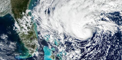
Tropical cyclones have been growing stronger worldwide over the past 30 years, and not just the big ones that you hear about. Our new research finds that weak tropical cyclones have gotten at least 15% more intense in ocean basins where they occur around the world. That means storms that might have caused minimal damage a few decades ago are growing more dangerous as the planet warms. Warmer oceans provide more energy for storms to intensify, and theory and climate models point to powerful storms growing stronger, but intensity isn’t easy to document. We found a way to measure intensity by using the ocean currents beneath the storms – with the help of thousands of floating beachball-sized labs called drifters that beam back measurements from around the world. Why it’s been tough to measure intensity Tropical cyclones are large storms with rotating winds and clouds that form over warm ocean water. They are known as tropical storms or hurricanes in the Atlantic...


