Atlantic hurricane season
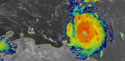
Hurricane Beryl was the latest Atlantic storm to rapidly intensify, growing quickly from a tropical storm into the strongest June hurricane on record in the Atlantic. It hit the Grenadine Islands with 150 mph winds and a destructive storm surge on July 1, 2024, then continued to intensify into the basin’s earliest Category 5 storm on record. Beryl was still a powerful Category 4 hurricane on July 3 when its eyewall brushed the coast of Jamaica and headed toward the Cayman Islands. A large part of Mexico’s Yucatan Peninsula was under a hurricane warning. The damage Beryl caused, particularly on Carriacou and Petite Martinique, was extensive, Grenada Prime Minister Dickon Mitchell told a news briefing. “In half an hour, Carriacou was flattened.” Beryl’s strength and rapid intensification were unusual for a storm so early in the season. This year, that is especially alarming as forecasters expect an exceptionally active Atlantic hurricane season....
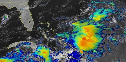
When tropical meteorologists peer at satellite images, they often catch sight of subtle cloud formations hinting at something more ominous brewing. The first signs of a potential hurricane can be detected days before a storm gains its fierce momentum. Wispy cirrus clouds radiating outward, the appearance of curved banding low-level clouds and a drop in atmospheric pressure are all clues. These early clues are crucial for predicting the onset of what might develop into a catastrophic hurricane. I am a meteorology professor at Penn State, and my research group uses satellites and computer models to improve forecasting of tropical weather systems. With an especially fierce Atlantic storm season forecast for 2024, being able to detect these initial signals and provide early warnings is more important than ever. Here’s what forecasters look for. Hurricane Harvey entered the Gulf of Mexico as a tropical wave before reorganizing into a tropical storm a...
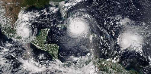
The 2024 Atlantic hurricane season starts on June 1, and forecasters are predicting an exceptionally active season. If the National Hurricane Center’s early forecast, released May 23, is right, the North Atlantic could see 17 to 25 named storms, eight to 13 hurricanes, and four to seven major hurricanes by the end of November. That’s the highest number of named storms in any NOAA preseason forecast. Other forecasts for the season have been just as intense. Colorado State University’s early outlook, released in April, predicted an average of 23 named storms, 11 hurricanes and five major hurricanes. The European Centre for Medium-Range Weather Forecasts anticipates 21 named storms. Colorado State also forecasts a whopping 210 accumulated cyclone energy units for 2024, and NOAA forecasts the second-highest ACE on record. Accumulated cyclone energy is a score for how active a given season is by combining intensity and duration of all storms occurring within a gi...
One of the big contributors to the record-breaking global temperatures over the past year – El Niño – is now gone, and its opposite, La Niña, is on the way. Whether that’s a relief or not depends in part on where you live. Above-normal temperatures are still forecast across the U.S. in summer 2024. And if you live along the U.S. Atlantic or Gulf coasts, La Niña can contribute to the worst possible combination of climate conditions for fueling hurricanes. Pedro DiNezio, an atmosphere and ocean scientist at the University of Colorado who studies El Niño and La Niña, explains why and what’s ahead. What is La Niña? La Niña and El Niño are the two extremes of a recurring climate pattern that can affect weather around the world. Forecasters know La Niña has arrived when temperatures in the eastern Pacific Ocean along the equator west of South America cool by at least half a degree Celsius (0.9 Fahrenheit) below no...
El Niño is officially here, and while it’s still weak right now, federal forecasters expect this global disrupter of worldwide weather patterns to gradually strengthen. That may sound ominous, but El Niño – Spanish for “the little boy” – is not malevolent, or even automatically bad. Here’s what forecasters expect, and what it means for the U.S. What is El Niño? El Niño is a climate pattern that starts with warm water building up in the tropical Pacific west of South America. This happens every three to seven years or so. It might last a few months or a couple of years. Normally, the trade winds push warm water away from the coast there, allowing cooler water to surface. But when the trade winds weaken, water near the equator can heat up, and that can have all kinds of effects through what are known as teleconnections. The ocean is so vast – covering approximately one-third of the planet, or about 15 times the size...


