Rapid intensification
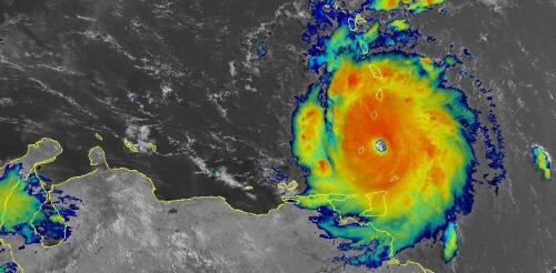
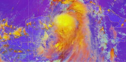
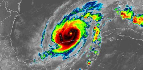
Hurricane Beryl was the latest Atlantic storm to rapidly intensify, growing quickly from a tropical storm into the strongest June hurricane on record in the Atlantic. It hit the Grenadine Islands with 150 mph winds and a destructive storm surge on July 1, 2024, then continued to intensify into the basin’s earliest Category 5 storm on record. Beryl was still a powerful Category 4 hurricane on July 3 when its eyewall brushed the coast of Jamaica and headed toward the Cayman Islands. A large part of Mexico’s Yucatan Peninsula was under a hurricane warning. The damage Beryl caused, particularly on Carriacou and Petite Martinique, was extensive, Grenada Prime Minister Dickon Mitchell told a news briefing. “In half an hour, Carriacou was flattened.” Beryl’s strength and rapid intensification were unusual for a storm so early in the season. This year, that is especially alarming as forecasters expect an exceptionally active Atlantic hurricane season....
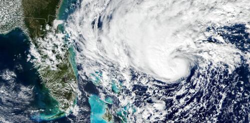
Forecasters expected Hurricane Idalia to intensify into a major hurricane as it headed over exceptionally warm waters in the Gulf of Mexico, on track for landfall in Florida on Wednesday, Aug. 30, 2023. Hurricane warnings were posted along a wide stretch of Florida’s Gulf coast, from near Sarasota to the Panhandle, including Tampa Bay. Hurricane scientist Haiyan Jiang of Florida International University explains how two conflicting forces – record-high ocean heat and wind shear, the latter influenced by El Niño – were determining Idalia’s future, and how they have made the 2023 hurricane season overall difficult to forecast. What role is ocean temperature playing in Idalia’s forecast? Forecasters are watching several factors, but the biggest is the very high sea surface temperature in the Gulf of Mexico. The Gulf is typically warm in late August, and we often see hurricanes this time of year. But this summer, the sea surface temperature has...
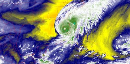
Hurricane Milton became one of the most rapidly intensifying storms on record as it went from barely hurricane strength to a dangerous Category 5 storm in less than a day on a path across the Gulf of Mexico toward Florida. With sustained winds that reached 180 mph on Oct. 7, 2024, and very low pressure, it also became one of the strongest Atlantic storms. Milton’s winds dipped to Category 4 strength early on Oct. 8, but forecasters warned that it would still be an extremely dangerous hurricane at landfall. Less than two weeks after Hurricane Helene’s devastating impact, this kind of storm was the last thing Florida wanted to see. Hurricane Milton was expected to make landfall as a major hurricane on Oct. 9 and had already prompted widespread evacuations. Hurricane Milton’s projected storm track, as of midday Oct. 7, 2024, as it grew into a major hurricane (M). Storm tracks are projections, and Milton’s path co...
Tropical cyclones have been growing stronger worldwide over the past 30 years, and not just the big ones that you hear about. Our new research finds that weak tropical cyclones have gotten at least 15% more intense in ocean basins where they occur around the world. That means storms that might have caused minimal damage a few decades ago are growing more dangerous as the planet warms. Warmer oceans provide more energy for storms to intensify, and theory and climate models point to powerful storms growing stronger, but intensity isn’t easy to document. We found a way to measure intensity by using the ocean currents beneath the storms – with the help of thousands of floating beachball-sized labs called drifters that beam back measurements from around the world. Why it’s been tough to measure intensity Tropical cyclones are large storms with rotating winds and clouds that form over warm ocean water. They are known as tropical storms or hurricanes in the Atlantic...
Hurricane Ian hit Florida in September 2022 as one of the United States’ most powerful hurricanes on record, and it followed a two-week string of massive, devastating storms around the world. A few days earlier in the Philippines, Typhoon Noru gave new meaning to rapid intensification when it blew up from a tropical storm with 50 mph winds to a Category 5 monster with 155 mph winds the next day. Hurricane Fiona flooded Puerto Rico, then became Canada’s most intense storm on record. Typhoon Merbok gained strength over a warm Pacific Ocean and tore up over 1,000 miles of the Alaska coast. Major storms hit from the Philippines in the western Pacific to the Canary Islands in the eastern Atlantic, to Japan and Florida in the middle latitudes and western Alaska and the Canadian Maritimes in the high latitudes. A lot of people are asking about the role rising global temperatures play in storms like these. It’s not always a simple answer....
