Typhoon
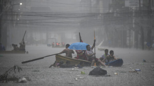
Relentless rain drenched the northern Philippines on Wednesday (Jul 24), triggering floods in Manila and deadly landslides as Typhoon Gaemi intensified the seasonal monsoon. Rescuers were deployed across the densely populated capital to help evacuate people from low-lying homes after downpours turned streets into rivers, trapping vehicles. People clutched flimsy umbrellas as they waded through thigh-deep murky water or used small boats and shopping trolleys to move around. “The disturbance it caused is great. The waters reached the second floor of our house,” Nora Clet, a resident, told AFP. Restaurant employee Rex Morano said he was not able to work due to the “very high” floodwaters. A state of calamity was declared for Manila, unlocking funds for relief efforts, after the state weather forecaster warned of “serious flooding” in some areas. Government offices were shut and classes suspended, more than 10...
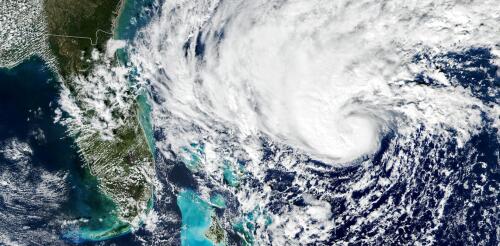
Tropical cyclones have been growing stronger worldwide over the past 30 years, and not just the big ones that you hear about. Our new research finds that weak tropical cyclones have gotten at least 15% more intense in ocean basins where they occur around the world. That means storms that might have caused minimal damage a few decades ago are growing more dangerous as the planet warms. Warmer oceans provide more energy for storms to intensify, and theory and climate models point to powerful storms growing stronger, but intensity isn’t easy to document. We found a way to measure intensity by using the ocean currents beneath the storms – with the help of thousands of floating beachball-sized labs called drifters that beam back measurements from around the world. Why it’s been tough to measure intensity Tropical cyclones are large storms with rotating winds and clouds that form over warm ocean water. They are known as tropical storms or hurricanes in the Atlantic...
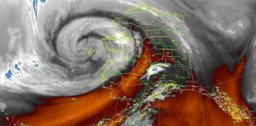
The powerful remnants of Typhoon Merbok pounded Alaska’s western coast on Sept. 17, 2022, pushing homes off their foundations and tearing apart protective berms as water flooded communities. Storms aren’t unusual here, but Merbok built up over unusually warm water. Its waves reached 50 feet over the Bering Sea, and its storm surge sent water levels into communities at near record highs along with near hurricane-force winds. Merbok also hit during the fall subsistence harvest season, when the region’s Indigenous communities are stocking up food for the winter. Rick Thoman, a climate scientist at the University of Alaska Fairbanks, explained why the storm was unusual and the impact it’s having on coastal Alaskans. What stands out the most about this storm? It isn’t unusual for typhoons to affect some portion of Alaska, typically in the fall, but Merbok was different. It formed in a part of the Pacific, far east of Japan, where historically few ty...


