Ocean Temperature
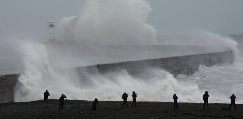
As oceans waves rise and fall, they apply forces to the sea floor below and generate seismic waves. These seismic waves are so powerful and widespread that they show up as a steady thrum on seismographs, the same instruments used to monitor and study earthquakes. That wave signal has been getting more intense in recent decades, reflecting increasingly stormy seas and higher ocean swell. In a new study in the journal Nature Communications, colleagues and I tracked that increase around the world over the past four decades. These global data, along with other ocean, satellite and regional seismic studies, show a decadeslong increase in wave energy that coincides with increasing storminess attributed to rising global temperatures. What seismology has to do with ocean waves Global seismographic networks are best known for monitoring and studying earthquakes and for allowing scientists to create images of the planet’s deep interior. These highly sensitive instruments continu...
El Niño is officially here, and while it’s still weak right now, federal forecasters expect this global disrupter of worldwide weather patterns to gradually strengthen. That may sound ominous, but El Niño – Spanish for “the little boy” – is not malevolent, or even automatically bad. Here’s what forecasters expect, and what it means for the U.S. What is El Niño? El Niño is a climate pattern that starts with warm water building up in the tropical Pacific west of South America. This happens every three to seven years or so. It might last a few months or a couple of years. Normally, the trade winds push warm water away from the coast there, allowing cooler water to surface. But when the trade winds weaken, water near the equator can heat up, and that can have all kinds of effects through what are known as teleconnections. The ocean is so vast – covering approximately one-third of the planet, or about 15 times the size...
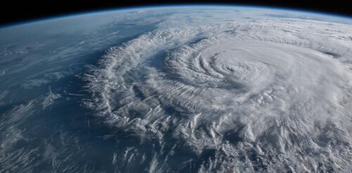
The Atlantic hurricane season starts on June 1, and forecasters are keeping a close eye on rising ocean temperatures, and not just in the Atlantic. Globally, warm sea surface temperatures that can fuel hurricanes have been off the charts in the spring of 2023, but what really matters for Atlantic hurricanes are the ocean temperatures in two locations: the North Atlantic basin, where hurricanes are born and intensify, and the eastern-central tropical Pacific Ocean, where El Niño forms. This year, the two are in conflict – and likely to exert counteracting influences on the crucial conditions that can make or break an Atlantic hurricane season. The result could be good news for the Caribbean and Atlantic coasts: a near-average hurricane season. But forecasters are warning that that hurricane forecast hinges on El Niño panning out. Ingredients of a hurricane In general, hurricanes are more likely to form and intensify when a tropical low-pressure system encounter...
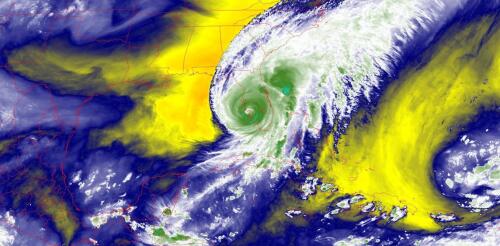
Hurricane Ian hit Florida in September 2022 as one of the United States’ most powerful hurricanes on record, and it followed a two-week string of massive, devastating storms around the world. A few days earlier in the Philippines, Typhoon Noru gave new meaning to rapid intensification when it blew up from a tropical storm with 50 mph winds to a Category 5 monster with 155 mph winds the next day. Hurricane Fiona flooded Puerto Rico, then became Canada’s most intense storm on record. Typhoon Merbok gained strength over a warm Pacific Ocean and tore up over 1,000 miles of the Alaska coast. Major storms hit from the Philippines in the western Pacific to the Canary Islands in the eastern Atlantic, to Japan and Florida in the middle latitudes and western Alaska and the Canadian Maritimes in the high latitudes. A lot of people are asking about the role rising global temperatures play in storms like these. It’s not always a simple answer....
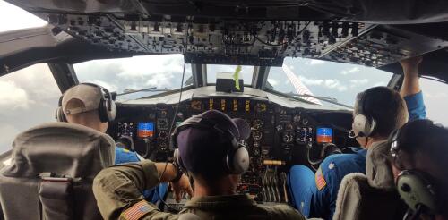
As a hurricane intensifies, hurricane hunters are in the sky doing something almost unimaginable: flying through the center of the storm. With each pass, the scientists aboard these planes take measurements that satellites can’t and send them to forecasters at the National Hurricane Center. Jason Dunion, a University of Miami meteorologist, has led hurricane field programs for the National Oceanic and Atmospheric Administration. He described the technology the team uses to gauge hurricane behavior in real time and the experience aboard a P-3 Orion as it plunges through the eyewall of a hurricane. What happens aboard a hurricane hunter when you fly into a storm? Basically, we’re take a flying laboratory into the heart of the hurricane, all the way up to Category 5s. While we’re flying, we’re crunching data and sending it to forecasters and climate modelers. In the P-3s, we routinely cut through the middle of the storm, right into the eye. Picture an X p...


